Categories
Events and People Historic Sites

Richard Allen and the Founding of Mother Bethel A.M.E. Church


Purchase Photo   View Nearby Photos
Throughout the 1700 and 1800s, Philadelphia was home to a large community of free African-Americans, many of whom were descendants of enslaved Africans forcibly brought to America. Members of the community formed churches, schools, businesses, and charitable societies. One of these churches, Mother Bethel African Methodist Episcopal (A.M.E.) Church, would become an important part of the community and influence African-American religious life throughout the country.

The history of Mother Bethel is inextricably bound up with the history of its founder, Richard Allen. Born into a slave-holding household in Philadelphia in 1760, Allen and his family were later sold to Stokeley Sturgis, a farmer in Delaware. In 1777 at the age of 17, Allen became a religious believer after hearing the preaching of a traveling Methodist pastor. Allen convinced his master to allow a minister to preach at the farm. When Sturgis heard the abolition influenced sermon, he agreed to allow Allen to buy his freedom. After three years of working nights and odd jobs, Allen became a free man at the age of 20.


Purchase Photo   View Nearby Photos
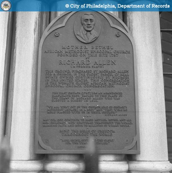
For the next few years, Allen supported himself by taking manual labor jobs while traveling extensively through several states and preaching on the Methodist circuit. In 1786, Allen was invited to preach to African-American members at St. George’s Methodist Church in Philadelphia where he was required to lead services at 5am so as to not interfere with the worship of the white congregants. As the African-American membership at St. George’s grew under Allen’s leadership, racial tensions in the congregation also increased. In 1787, Allen and Absalom Jones founded the Free African Society, an organization to provide aid to members of the black community. When Allen, Jones, and other African-Americans left St. George’s in protest of racial discrimination, they turned to the Free African Society as a source of religious leadership. The Society under Jones’ leadership would eventually organize the African Church, now known as the African Episcopal Church of St. Thomas, in 1792. Allen, however, wished to maintain a connection with the Methodist church and purchased land at 6th and Lombard Streets for the construction of a church. On July 29, 1794, Bethel Church was dedicated at the location. Facing interference from other Methodist congregations, Allen successfully fought in court for the right of Bethel to exist as an independent congregation. In 1816, Bethel joined with other black Methodist congregations to found the African Methodist Episcopal Church in America. Bethel became Mother Bethel and Allen was appointed the first bishop of the church.

Allen and Mother Bethel continued to play a role in the life of the free African-American community of Philadelphia. The church served as a stop on the Underground Railroad, and Allen remained an active leader of the church working for the rights of free and enslaved African-Americans. Constructed in the 1890s, the current Mother Bethel church building still sits at 6th and Lombard on the oldest parcel of real estate in the United States continuously owned by African-Americans. Richard Allen died on March 26, 1831. He and his wife Sarah are interred in a lower level of the church.


Sources

“About Us…History.” The African Episcopal Church of St. Thomas. http://www.aecst.org/about.htm

“About Us – Our History.” African Methodist Episcopal Church. http://www.ame-church.com/about-us/history.php

“History of the AME Church.” Mother Bethel African Methodist Episcopal Church.  http://www.motherbethel.com/museum.htm

“Richard Allen.” Africans in America. PBS Online. http://www.pbs.org/wgbh/aia/part3/3p97.html

Categories
Historic Sites

Entering America: The Washington Avenue Immigration Station


Purchase Photo   View Nearby Photos

In the early 1600s, Europeans began arriving in the Philadelphia area, inhabited at the time by members of the Lenape tribe. Over the next four hundred years, immigrants, affected by various social, political, geographic, and economic factors, would continue to leave their countries of origin and settle in Philadelphia. While the population of the United States grew throughout this time period, the late nineteenth and early twentieth centuries saw an especially large boom in the growth of cities. As the American population shifted from predominantly rural to predominantly urban, immigrants also began settling in cities in large numbers.

Despite its location over a hundred miles from the ocean, Philadelphia served as the port of entry for 1.3 million immigrants from 1815 to 1985. In 1873, two steamship lines, the American Line and the Red Star line, began regular steamship service between Europe and Philadelphia. Other companies also began offering service to Philadelphia including the Hamburg-American Line, which operated runs between Hamburg, Germany and Philadelphia beginning in 1898. From 1873 until the enacting of stricter immigration quotas in 1924, over one million immigrants arrived in Philadelphia. These immigrants received health inspections at various locations on the Delaware River before disembarking at the immigration stations in Philadelphia and passing through customs.


Purchase Photo   View Nearby Photos

The Washington Avenue Immigration Station, the first of these stations, was built by the Pennsylvania Railroad in the 1870s on a pier located where Washington Avenue approaches the Delaware River. After completing all their paperwork at the station, some immigrants found employment and housing in Philadelphia while others traveled on to different locations. Since the station was owned by the railroad, train tickets were readily available for purchase, and many immigrants chose to board trains for destinations throughout the United States. The Washington Avenue Station was demolished in 1915.

As in cities across the country, the increase in immigration to Philadelphia brought new cultural customs and traditions as well as ethnic and economic tensions that influenced the development of the city and continue to have an effect on American history and policy today.

Sources
Miller, Fredric M. “Immigration through the Port of Philadelphia.” In Forgotten Doors: The Other Ports of Entry to the United States, edited by M. Mark Stolarik, 37-54. Philadelphia: Balch Institute Press, 1988.

Miller, Fredric M. “Philadelphia: Immigrant City.” Balch Online Resources.

Sitarski, Stephen M. “From Weccacoe to South Philadelphia: The Changing Face of a Neighborhood.” Pennsylvania Legacies 7, no. 2 (November 2007).

Categories
Historic Sites Urban Planning

Broad Street Station

While intercity travel today primarily involves the automobile or airplane, a century ago the passenger train represented the principal mode of long distance travel. The increasing volume of rail passengers in the late 1800’s required railroads to find efficient ways of delivering passengers to their destinations. In Philadelphia, the problem for the Pennsylvania Railroad was the lack of a station that would deliver passengers directly into Center City Philadelphia. In 1879, the railroad devised a plan to construct a large passenger station at Broad and Market Streets, directly opposite City Hall. The station would be connected by multiple tracks to the Pennsylvania Railroad station located in West Philadelphia, across the Schuylkill River1. The extension would have required numerous street crossings, starting at 23rd St. and going eastward towards Broad Street. To avoid both the safety hazard of street crossings and the potential bottleneck they would create for the numerous passenger trains, it was decided to construct the tracks on an elevated embankment. Large granite blocks were used to enclose the embankment and over time the structure was often referred to as the “Chinese Wall” because of its resemblance to the Great Wall of China2. In later years this structure would become the bane of city planners because it was viewed as an impediment to development of the area north of Market Street3.

Broad Street Station was officially opened on December 5, 18814. The brick station was of Gothic design with a rather ornate Victorian appearance. Behind the station were four train sheds to protect passengers from the elements. The station was an immediate success, boasting 160 daily trains5. The volume of passenger traffic steadily increased, so that by 1886, the number of passengers using the station averaged a million per month6. As a consequence, in 1892, a mere eleven years after its opening, plans were submitted for the enlargement of the station. An office building that would serve as the Pennsylvania Railroad’s headquarters was designed by noted architect Frank Furness and added to the existing station7. The smaller train sheds were replaced by one massive train shed 306 feet wide and 591 feet long. The roof, made of wood and glass, was at its highest point 100 feet above the tracks8.

Already by 1910, the 16 tracks of the station saw 578 arrivals and departures daily9. At the same time, the success of Broad Street Station brought with it a number of problems. While it served well as a final stop for commuter traffic into Center City, it was inconvenient and time consuming for through trains because they were required to retrace their steps to West Philadelphia Station before continuing on their journey. The stub-ended design of Broad Street required arriving locomotives to back up and be turned on a turntable before they could depart, creating additional congestion. A partial solution was provided by the railroad’s electrification, allowing the use of multiple-unit commuter trains which could operate in either direction.

On June 11, 1923, a fire broke out below the station platforms and quickly spread to the train shed, engulfing the entire structure in flames. Within hours of the fire, the Pennsylvania Railroad marshaled a work force of some 3500 men to begin repairing the station. Within five days, all tracks and platforms were restored. The weakened train shed was dismantled and replaced with umbrella shelters10. However, the handwriting was on the wall for Broad Street Station.

Within two years, the Pennsylvania Railroad started drawing up an ambitious plan, referred to as the “Philadelphia Improvements,” that called for the construction of 30th Street Station as the railroad’s main passenger station in Philadelphia, replacing the West Philadelphia station11. The plan also called for the elimination of Broad Street Station, replacing it with an underground station for commuter trains, known as Broad Street Suburban Station (but usually referred to simply as Suburban Station). By 1929, the excavation for the trackwork leading to Suburban Station had begun, parallel to the north side of the Chinese Wall. A year later, the construction of 30th Street Station across the Schuylkill River began, and Broad Street Station’s days were numbered. Surprisingly, the station was used for two more decades before finally closing on April 27, 1952. Aboard the last train from the station rode the Philadelphia Orchestra, led by Eugene Ormandy conducting a rendition of “Auld Lange Syne”12. Within a year, the station was demolished, making way for Penn Plaza and a series of high rise office buildings.


[1] Pennypacker, Bert (December 1983). “The Grandest Railway Terminal in America”. Trains (Kalmbach Publishing Co.): 40-57. ISSN 0041-0934.

[2] Albrecht, Harry P. [1972] (1976). Broad Street Station. Clifton Heights, Pennsylvania: Harry P. Albrecht. p. 3.

[3] Underkofler, Allen P (1987). “The Philadelphia Improvements, Part I”. The High Line (Philadelphia Chapter, Pennsylvania Railroad Technical and Historical Society) 2 (2 & 3). p. 5.

[4] Albrecht, p. 3.

[5] Pennypacker, p. 44.

[6] Ibid., p. 45.

[7] Messer, David W. (2000). Triumph III: Philadelphia Terminal 1838-2000. Baltimore, Maryland: Barnard, Roberts & Co. ISBN 0-934118-25-6

[8] Pennypacker, pp. 46-47.

[9] Ibid., p. 49.

[10] Ibid., pp. 51-52.

[11] Underkofler, pp. 6-15.

[12] Pennypacker, p. 57.

Categories
Historic Sites

Mapping the Sesquicentennial

Many of the photographs in the Philadelphia Department of Records City Archives’ collection are associated with a particular location. As photographers from the City’s Photography Unit traveled around Philadelphia capturing images of construction projects, school yards, busy commercial districts, and residential areas, they often noted the address or intersection where the photograph was taken. The other collections available on PhillyHistory.org- the photographs from the Philadelphia Water Department, the property maps from the Department of Records, and the historic maps from the Free Library- are also very geographic in nature and usually connected to a specific place in the city. Using the address or intersection associated with an image, a photo can be geocoded (mapped) to that location. Once a photograph has been geocoded in PhillyHistory.org, it can be found using the address or neighborhood search, making it convenient to view photos or maps based on the location where they were taken.Like the other photographs and maps on PhillyHistory.org, the collection of photographs from the Sesquicentennial International Exposition has a geographic element. The majority of the photographs were taken on the Sesquicentennial grounds in the area around the intersection of Broad Street and Pattison Avenue by present-day FDR Park and the stadiums. Many of the photographs depict buildings, attractions, or exhibits at the Sesquicentennial but do not give specific addresses or intersections where these places were located. Thanks to the staff at the City Archives, a copy of the Sesqui-Centennial International Exposition General Plan was located (also available in the “Sesquicentennial Exposition” article on Wikipedia). This plan, published in the Sesquicentennial Promotional Booklet 1926, provided a map of many of the buildings on the Sesquicentennial grounds and showed the main roads that ran through the area- Broad Street, Pattison Avenue, Packer Avenue, and Moyamensing Avenue.While those four streets have remained the same, the rest of the area had changed considerably from the time of the Sesquicentennial in 1926 to the present. Streets that were created for the Sesquicentennial no longer exist, and areas that were open land in 1926 are now filled with roads and buildings. Using the Sesquicentennial General Plan, it was easy to see where the buildings existed in 1926, but the changing landscape made it much trickier to match those 84 year old locations with a Philadelphia street map from 2008. Since the geocoding system uses current street maps, it was necessary to find some way to sync the older map with the newer map in order to accurately geocode the photographs.

The solution to the problem came in the form of a piece of Geographic Information Systems (GIS) mapping software. One of the PhillyHistory.org software developers used the software to overlay the historic Sesquicentennial map with a current Philadelphia street map. To ensure that the maps had the same orientation, he found several points that were in the same location on both maps- the intersections of Oregon Avenue and Moyamensing Avenue, Broad Street and Packer Avenue, and Broad Street and Pattison Avenue. By lining up the two maps using these three intersections, a reliable composite map of the two images was made. To download a copy of the map, visit Azavea Commons. Azavea is the software company who created PhillyHistory.org for the Philadelphia Department of Records.

This two-layer map proved to be a valuable tool for geocoding the Sesquicentennial photographs. Using the historic map, PhillyHistory.org staff could see that the Nuremberg section of the Exposition was located south of Packer Avenue and several blocks west of Broad Street but could not determine a more accurate location. With the two-layer map, however, it was easy to see that the Nuremberg area was located precisely at what is now the intersection of 18th Street and Schley Street. Thanks to the assistance of the software developers and Archives staff, the PhillyHistory.org team was able to geocode a large number of Sesquicentennial photos, making them easy to locate on PhillyHistory.org and providing an illustration of how technology can help us relate the past to the present.

Categories
Historic Sites

From Shipways to Runways: the Transformation of Hog Island, Part Two

Whether it was the poor conditions of the site or a tough winter or contractors’ graft, preparatory construction began to drag on interminably, leading Congress to investigate the goings on at Hog Island. By February of 1918, seven months after the issuance of Hog Island’s contract, a New York Times reporter touring the site was surprised to hear no sound of rivets on steel and only 12 of the planned 50 shipways completed.[1] The Shipping Board’s chief constructor had investigated the site a month earlier and cynically announced that it would be a wonder if the yard produced a ship “at all” in 1918. Compounding the frustration was the mounting cost of doing nearly anything on Hog Island, mainly the result of the cost-plus-profit contract system that placed expediency before oversight. Initially, the American International Corporation estimated the cost of the yard at $35,000,000. By the time the first ship came off the ways on December 3, 1918—almost a month after the Armistice—the cost of constructing the site had ballooned to $66 million. In their defense, the officers of the American International Corporation began to take a long view of the utility of the site. Perhaps not of great service to the war effort, Hog Island would be a boon to Philadelphia. At a meeting of the Philadelphia Chamber of Commerce, the chairman of the American International Shipbuilding Corporation promised postwar employment for 100,000 Philadelphians. Hog Island, he argued, would make Philadelphia the greatest shipbuilding center in the world.[2]

Despite the rancor surrounding the yard’s construction and operation, Hog Island only existed because of the backbreaking labor of nearly 30,000 workers laboring throughout the cold winter of 1917-1918. Before the canteens and the YMCA, there were rough accommodations and hardship. Steam injections softened the frozen ground before workers could excavate for sewer lines. Other workers waded into the cold Delaware to dig out the channels for the shipways. Simultaneous to the attention-grabbing headlines of mismanagement and corporate greed was the untold story of a unique identity forming among the “Hoggies”. They worked among their friends—blacks, Italians, Polish, Irish, and Germans—all under the glaring eyes of the foreman, the engineer, and the military policeman. And though they may have lived in barracks near where they worked, they brought their traditions, faith, and foods such as the bulky fortifying sandwich that took on the island’s name. On December 23, 1918, the boys band from St. Francis Xavier-Holy Name parishes played for a flag raising in the bitter cold. During their down time, the Hog Islanders squared off on the gridiron against the other military installations up and down the river. Much like the soldiers in the field, the “Hoggies” who worked the shipways during the war were forced to coexist and cooperate, drawing strength from the uniqueness of their difficult work.[3]

Although massive preparation time meant that the $66 million Hog Island Yard failed to produce a single ship during wartime, the yard continued its contract assembling 122 ships from prefabricated parts. Most of these sturdy utilitarian Hog Islanders saw action in World War II but suffered high losses. Despite assurances that Hog Island would turn Philadelphia into the Clyde of America, the shipways went silent in 1921 and the timbering and piers beginning to rot, vegetation growing up through the corduroy roads. In 1925, the City purchased land near Hog Island for a municipal airfield to handle the growing traffic in passenger planes. Eyeing the derelict Hog Island property to the south with its rail lines and shipways still intact, members of the Philadelphia Business Progress Committee began advocating for an air-marine-rail terminal on the site of the old shipyard. In 1930, the City paid $3 million for the flat, well-prepared Hog Island site. As the airport expanded, its runways devoured the entire Hog Island shipyard—one monstrous technological machine consuming another.


[1] “Senate Committee to Go to Hog Island, Piez Shows Big Financial Affiliations of the Corporation’s Directors,” The New York Times, 16 February 1918.


[2] James J. Martin, “The Saga of Hog Island, 1917-1920: The Story of the First Great War Boondoggle,” The Saga of Hog Island: And Other Essays in Inconvenient History (Colorado Springs, Co: Ralph Myles, 1977). http://tmh.floonet.net/articles/hogisle.shtml


[3] “Hog Island,” Philadelphia Record Photograph Collection, Historical Society of Pennsylvania. Although there are contrary claims, linguist William Labov has demonstrated that the lexical root of the word “hoagie” was “hog-“ or “hogg” after World War I. See William Labov, “Pursuing the Cascade Model,” 25 November 2002, http://www.ling.upenn.edu/~wlabov/Papers/PCM.html. This is also borne out in Eames, Edwin and Howard Robboy. 1967. “The sociocultural context of an American dietary item.” The Cornell Journal of Social Relations 2:63-75, p. 4.

Categories
Historic Sites

From Shipways to Runways: the Transformation of Hog Island, Part One


Purchase Photo   View Nearby Photos
Soon after America declared war on Germany in April 1917, songwriter George M. Cohan released his jaunty, rousing call to arms “Over There”. But despite the popular fervor to take the fight to Europe, the U.S. did not possess the merchant fleet to make war “over there.” With only 430 cargo and passenger ships in its merchant marine, America relied on foreign ships for nearly 90 percent of its overseas trade.[1] Successful German U-boat campaigns in the early months of the war exacerbated the shortage.

With a meager merchant fleet unprepared to serve its troops overseas, the Wilson administration turned to the private sector for assistance. Eventually the government would run 132 shipyards spending over $200 million on ship construction. But no yard was more ambitious and controversial than Hog Island, where the Philadelphia International Airport is presently located. On 31 July 1917, under the aegis of the Emergency Fleet Corporation, the government lavished a multimillion dollar contract on a nebulous conglomerate, the American International Corporation, to construct a massive shipyard on boggy land a company subsidiary had advantageously purchased two months earlier. Paying twenty times the assessed value for the land, the American International Shipbuilding Corporation set its dredges to work. Ceaselessly throughout the summer and fall of 1917, the dredges bolstered the flat island with millions of tons of Delaware River spoil.[2]

From the perspective of the popular press, the process of turning the 860-acre tract “where formerly the song of the mosquito was the only sound to greet the ear of the surveyor or fisherman” into a teeming military industrial complex inspired the same pride in America as Cohan’s martial ditty. National Geographic called Hog Island a “wonderful industrial center” in September 1918. The Historical Outlook, a magazine for teachers published in Philadelphia noted where once was “a low lying unsanitary swamp—merely a strip of wasteland” stood forth the next summer “the greatest shipyard in the world.” In many ways, Hog Island was a projection of early 20th century American idealism—capital, technology, and scientific management in the service of progress.


Purchase Photo   View Nearby Photos

But in other ways, Hog Island was too big for its own good. The contractual obligation to supply “at least” 200 ships meant massive expenditures for site preparation and infrastructure were needed. Writers were fond of hyperbolic comparisons of the yard’s infrastructure to major American cities. Hog Island’s electrical power plant was sufficient to light the combined needs of Albany, NY and Richmond, VA. Its water system could deliver twice the capacity of the city of Atlanta. Its sewer system was equal to that of Minneapolis. With its 70 miles of rail lines sustaining twenty locomotives and 465 freight cars, 250 buildings, 3,000,000 feet of underground wiring, a hospital, trade school, 12 canteens and restaurants, hotel, 5 mess halls, and telephone traffic equal to a town of 140,000, comparisons to a small city were apt.[3]


[1] “Ugly Ducklings,” Time, 13 January 1941.

[2] James J. Martin, “The Saga of Hog Island, 1917-1920: The Story of the First Great War Boondoggle,” The Saga of Hog Island: And Other Essays in Inconvenient History (Colorado Springs, Co: Ralph Myles, 1977). http://tmh.floonet.net/articles/hogisle.shtml

[3] Ralph A. Graves, “Ships for the Seven Seas: The story of America’s Maritime Needs, Her Capabilities, and Her Achievements,” The National Geographic Magazine, Vol. XXXIV, No. 3, September, 1918.

“A Few Facts About Hog Island: the Greatest Shipyard in the World,” the American International Shipbuilding Corporation, 5 August 1918.

Categories
Historic Sites

Recreating the Philadelphia of 1776


Purchase Photo   View Nearby Photos
The preparations for the Sesquicentennial as well as all the events, activities, and buildings that were a part of the celebration required a large amount of organization and management. The administration of the Sesquicentennial was performed by a Board of Directors, an Executive Committee, and a variety of individual committees (including the Automobile Traffic Committee, Music Committee, and Publicity Committee) that managed specific areas of the Exposition.

Although the Board of Directors and various committees included female members, a separate Women’s Committee was also formed on October 16, 1925. The group originally included one hundred members appointed by Mayor W. Freeland Kendrick, the Mayor of Philadelphia and President of the Sesquicentennial, with Mrs. J. Willis Martin serving as leader of the Women’s Board. On February 8, 1926, the group decided to become a large general committee. This committee would eventually have over two thousands members and include over forty sub-committees.[1]

Among their many contributions, the Women’s Committee promoted the Sesquicentennial across the country, served as hostesses and greeters at several Exposition buildings, and established and maintained information booths at hotels, railroad stations, and other locations across Philadelphia.[2] The Women’s Committee, as well as many members of the Board of Directors and visitors to the Exposition, considered their greatest contribution to be the construction and management of High Street, a recreation of High Street (later known as Market Street) in Philadelphia in 1776 that included 20 houses, the Market Place, the Town Hall, and several gardens. Each house such as the Girard Counting House, Franklin Print Shoppe, and Jefferson House was maintained by a different women’s organization and decorated in a style consistent with the Revolutionary period.[3] Activities on the street included appearances by the town crier, daily marionette performances, and weekly pageants. High Street saw a large amount of visitors during the Sesquicentennial and one newspaper reporter wrote that “here is another place to linger, and many do linger.”[4]


Purchase Photo   View Nearby Photos

While High Street attracted many visitors, it also presented an idealized view of American history. Dirt, lawlessness, discord, and injustice did not exist in the reconstructed High Street. One hostess who spoke with visitors on High Street saw the reconstruction as a way to demonstrate that the country’s beginnings were dignified rather than chaotic and tawdry.[5] High Street at the Sesquicentennial was one of several living history museums and parks that were formed beginning in the 1920s. These institutions, such as Colonial Williamsburg and Greenfield Village, would prove popular among visitors but also become the object of debate regarding the accuracy of their representations of history.

As an attraction at the Sesquicentennial, High Street showed the commitment of large numbers of women and women’s organizations to the Exposition. Although the Sesquicentennial did not achieve financial success and suffered from disorganization and low attendance, High Street proved to be a popular attraction according to the fair’s organizers who stated that it “was a source of renewed confidence in the deep foundations of American life, and as such it undoubtedly had a lasting effect on the millions who visited it.”[6]


[1] Austin, E.L. and Odell Hauser, Editors. The Sesqui-Centennial International Exposition: A Record Based on Official Data and Departmental Reports. Philadelphia: Current Publications, Inc., 1929, p. 153.

[2] Ibid., 157-158.

[3] Ibid., 161-162.

[4] The New York Times. “Sesquicentennial is Now Complete.” August 22, 1926.

[5] Conn, Steven. Museums and American Intellectual Life: 1876-1926. Chicago: University of Chicago Press, 1998, 241.

[6] Austin, E.L. and Odell Hauser, Editors. The Sesqui-Centennial International Exposition: A Record Based on Official Data and Departmental Reports. Philadelphia: Current Publications, Inc., 1929, p. 20.

Categories
Historic Sites

Constructing a 150th Birthday Celebration


Purchase Photo   View Nearby Photos

Spread over a large portion of land in the south portion of Philadelphia along the Delaware River, the Sesquicentennial Exposition featured huge buildings filled with exhibitors, technical innovations, and displays from around the world. These huge halls, along with a new stadium, a military encampment, and a recreation of a Philadelphia street in 1776, served as a way to attract visitors to the six month long celebration of the nation’s independence.   

The enormity of the Exposition and its buildings was demonstrated even before visitors reached the Sesquicentennial Exposition main entrance located at the intersection of Broad Street and Packer Avenue. As individuals approached the Exposition grounds, they passed underneath an 80 foot tall reproduction of the Liberty Bell covered with 26,000 fifteen-watt lamps. Built at a cost of $100,000, the Liberty Bell was said to be visible from large portions of Philadelphia when it was lit at night. [1]

Like the Liberty Bell, buildings that were grand in size would be a dominant feature of the Sesquicentennial. Three large exhibit halls each contained over 320,000 square feet of floor space to be used for displays and demonstrations. [2] One of these halls, the Palace of United States Government, Machinery, and Transportation, covered 11.5 acres of land and included exhibits related to industry and transportation. Another hall, the Palace of Liberal Arts and Manufactures, covered 7.75 acres of land located near the intersection of Broad Street and Packer Avenue and contained over 50,000 square feet of exhibits devoted just to the displays and goods of Great Britain and Ireland. [3] Even the Administration Building, which held offices for Sesquicentennial officials and their staffs and was located near the intersection of Oregon Avenue and Moyamensing Avenue, was 17,600 square feet.


Purchase Photo   View Nearby Photos

Despite the immensity of the completed halls, the original plans for the Sesquicentennial grounds included many more buildings that were greater in size and more elaborate in ornamentation. A lack of money and insufficient time to complete construction, however, forced organizers to dramatically alter the original plans to ensure that all building would be completed by the time of the official opening of the Sesquicentennial on July 4, 1926. In protest of these budget and construction cuts, Colonel David C. Collier, Director-General of the Exposition, resigned on October 29, 1925. [4]

Collier’s resignation was just one of many difficulties facing the administrators of the Sesquicentennial Exposition as they attempted to organize such a large scale celebration. By the end of 1925, some members of the Sesquicentennial administrative staff were still so fearful that construction would not be completed by the opening date that they urged the National Advisory Commission to postpone the Sesquicentennial until 1927. After much debate, the Commission decided against postponement and kept the opening day of the Exposition as May 31, 1926.[5] While the major halls were structurally complete by May 31, few of the exhibitors had installed their displays. Many of the smaller buildings were also still being constructed and much of the landscaping had not been finished. Visitors on opening day expressed disappointment at the state of the Sesquicentennial grounds and exhibits, but officials estimated that the exposition was 75 percent complete. [6] Construction and exhibit installation continued at a feverish pace after the opening day, and the majority of the buildings and displays were completed by the time of the official dedication of the Sesquicentennial Exposition on July 4, 1926.

[1] Austin, E.L. and Odell Hauser, Editors. The Sesqui-Centennial International Exposition: A Record Based on Official Data and Departmental Reports. Philadelphia: Current Publications, Inc., 1929, p. 67.  

[2] Austin, E.L. and Odell Hauser, Editors. The Sesqui-Centennial International Exposition: A Record Based on Official Data and Departmental Reports. Philadelphia: Current Publications, Inc., 1929, p. 64-65. 

[3] Emery, Steuart M. “Sesquicentennial Fair Shows Our Progress.” New York Times, May 23, 1926.

[4] Austin, E.L. and Odell Hauser, Editors. The Sesqui-Centennial International Exposition: A Record Based on Official Data and Departmental Reports. Philadelphia: Current Publications, Inc., 1929, p. 44. 

[5] Austin, E.L. and Odell Hauser, Editors. The Sesqui-Centennial International Exposition: A Record Based on Official Data and Departmental Reports. Philadelphia: Current Publications, Inc., 1929, p. 45. 

[6] New York Times. “Sesquicentennial Opens as Sun Shines; 100,000 Pass Gates.” June 1, 1926.

Categories
Historic Sites

Teaching the Sciences in Philadelphia


Today the Atwater Kent Museum is a modest-sized museum of city history, but it was built in 1826 as the original Franklin Institute – a school dedicated to the mechanical arts, science, technology and research.

The groundwork of the industrial revolution was laid in the early decades of the 19th century with the advent of steam power, small machine shops, and advances in chemistry and physics. Philadelphia was among the cities in the forefront of the nascent industrial age. Technical schools were being founded at this time in European and some American cities.  Local businessman Samuel Vaughn Merrick and science professor William H. Keating hatched the idea for such a school in Philadelphia in late 1823. Other leaders of the city joined the effort and a series of lectures was soon launched the next year in rented space at Carpenters’ Hall and the original University of Pennsylvania at 4th and Arch. The school was an immediate success with 600 paying members in the first year. Mostly these members were young craftsmen and apprentices interested in improving their knowledge of engineering, the science behind the new advances.

Naming the organization after Philadelphia’s most famous man of science, Ben Franklin, was a natural. After only one year, the Institute was planning it own building on a vacant lot on 7th Street near Market, and a source of funding appeared when the federal government agreed to a long-term lease for federal courts in part of the proposed building. John Haviland was selected as architect. Perhaps his most famous work is Eastern State Penitentiary, which influenced the design of prisons around the world. The new building for the Institute was about 60 feet wide and 100 feet long in the neo-classical style.

Some of the most important names in Philadelphia science and industry taught or lectured there. Men such as architects William Strictland and Thomas U. Walter and industrialists Matthias Baldwin, Isaiah Lukens, William Sellers. A host of scholars and scientists were associated with the Institute including Alexander Dallas Bache and Frederick Graff.


Today the Franklin Institute on the Benjamin Franklin Parkway is known as an outstanding science museum, but for decades it was much more. The Institute took on scores of research projects. It was also an early testing lab trying to determine if new inventions really worked. The first scientific study of water power drew international attention. The federal government helped finance a study there to determine how to make steam engines safe following disastrous explosions on steamboats. Later, it was the Franklin Institute that spearheaded a movement and devised ways to standardize threads and sizes for nuts and bolts.

The Institute also published a technical and science journal and sponsored contests for inventors. Evening lectures were a huge success. Those who paid their annual $3 dues could attend all lectures for free. From the start, women were admitted to all lectures. Drafting classes were particularly popular.

After 109 years of use, the building was abandoned when the Franklin Institute moved to the Parkway in 1933. It stood vacant and was scheduled for demolition when dynamic society woman Frances Ann Wistar launched a campaign to save it. She enlisted the aid of industrialist A. Atwater Kent, who had already provided the funding to preserve the Betsy Ross House.

Kent had been a pioneer in manufacturing auto parts and electrical appliances. He jumped into the new radio business in 1921 with much success. His Atwater Kent radio factory employed 12,000 workers at its peak. He purchased the building that now bears his name, which was dedicated in 1941 as a museum of Philadelphia history. The facade of the building hasn’t changed since the day it opened.

References:
  • Sinclair, Bruce. Philadelphia‘s Philosopher Mechanics: A History of the Franklin Institute, 1824–1865. Baltimore: Johns Hopkins University Press, 1974.

Categories
Historic Sites

From Musket Balls to Basketballs- The Sparks Shot Tower


Purchase Photo   View Nearby Photos
Perhaps it is still standing because it would cost too much to demolish. The Sparks Shot Tower – for many years the tallest structure in Philadelphia – is now part of a city recreation center. Instead of making tons of musket balls, birdshot and bullets, the 142-foot tower looms above an indoor basketball court.

The Sparks Shot Tower has been a South Philadelphia landmark since 1808. Located at Front and Carpenter Streets, it’s easily seen by passing motorists on I-95. Most people probably assume it’s a tall smoke stack from some long-defunct factory. It is, indeed, a 200-year-old industrial artifact. When the brick tower was first built, it represented a revolutionary new technology in the manufacture of lead ammunition. The technology was born in Great Britain where it was discovered that dropping molten lead from a high place caused it to form perfectly round balls as it fell. The lead was poured through a mesh that gave the balls the proper sizes. The hot balls fell into a large vat of water.

Until this discovery, musket balls were fashioned by pouring the lead into wooden molds. The new technique made it many times quicker and cheaper to make ammunition. Tons of shot was imported to America until President Thomas Jefferson imposed the Embargo Act in 1807. During the Napoleonic Wars, both France and Great Britain began seizing ships from neutral nations headed toward enemy ports. Jefferson’s answer was to ban trading with both nations.

According to a long-told story, Thomas Sparks and John Bishop were out hunting water fowl in the swamps in South Philly when they began discussing the high price of lead shot caused by the embargo and hit on the idea of building their own shot tower. Another partner in the project was James Clement.  All three were experienced in working with lead. The partners found someone who had worked in a British shot tower to advise them. The tower is said to be a sterling example of Philadelphia brickwork. Topped by a cone-shaped roof, the tower is 30 feet in diameter at the base and tapers to 15 feet. “Members of the United States Lighthouse Board have frequently repaired to its site to copy the model and afterward re-embody it in a lighthouse,” according to an 1875 book on Philadelphia industry.


Purchase Photo   View Nearby Photos

There is some debate over the claim that the Queen Village landmark was the first American shot tower. A stone shot tower in Wythe County, Va., along the New River, was built about the same time. It still stands along with Sparks and three other American shot towers. Within a year of the opening of the Sparks Shot Tower, Philadelphian Paul Beck built an even larger tower along the Schuylkill River, but it is long gone.

During the War of 1812, the Sparks Shot Tower was in full operation selling ammunition to the federal government. Bishop left the enterprise because he was devout Quaker who felt he could not support war in any form. The third partner also eventually left. At some point machinery was installed in a nearby building to make the conical bullets that replaced most lead shot. Four generations of the Sparks family continued operations until 1903 when the business was sold.

In 1913, the city purchased the shot tower and surrounding grounds to create a playground for a neighborhood teeming with immigrants and the poor. The entrance to the tower is sealed off and few have entered it in decades.

Sources

Avery, Ron. Beyond the Liberty Bell. Philadelphia: Broad Street Books, 1991.

Workshop of the World. Oliver Evans Press, 1990. http://www.workshopoftheworld.com/index.html

There is also a large amount of research on shot towers available on various websites.